
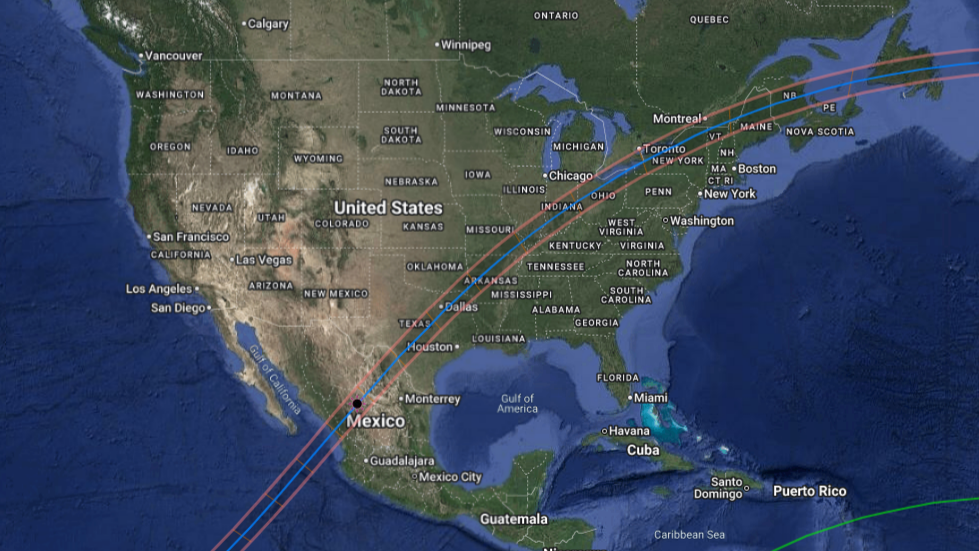
April 8th, 2024 Total Solar Eclipse Map Overviews
Launch Sites
The interactive map below includes the teams' institution locations and planned launch sites for the April 8, 2024 total eclipse. Click the square in the upper right to expand and then toggle layers on and off in the left sidebar.
Flight Predictions
Below are links to interactive Google maps showing flight predictions from different states using historic weather data from April 7, 8, and 9 in each 2019, 2020, 2021, and 2022. Each path of dots represents a different prediction day. Using the panel on the left, the trajectories for each of the different locations can be toggled on and off by clicking the red/orange check mark box.
The trajectories are color coated in 4500-meter increments, with the purple/darker colors being the lower altitudes and the red/brighter colors being the higher altitudes. The floating altitude and duration for these trajectories are 22860 meters (75,000 feet) and 60 minutes.
The trajectories are color coated in 4500-meter increments, with the purple/darker colors being the lower altitudes and the red/brighter colors being the higher altitudes. The floating altitude and duration for these trajectories are 22860 meters (75,000 feet) and 60 minutes.