
Stratospheric Ballooning
Stratospheric ballooning, or high altitude ballooning, utilizes balloons to travel to the edge of the stratosphere.
Academic Scientific Ballooning
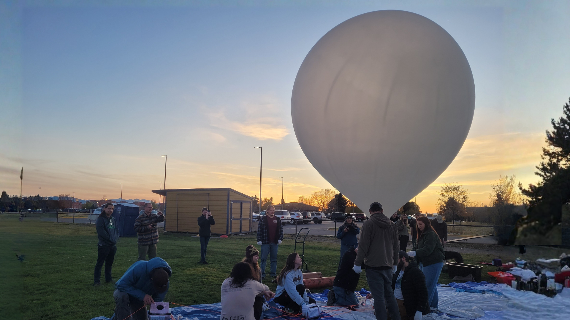
This type of stratospheric ballooning is incredibly valuable. Scientific ballooning has been a common since the early 2000s for hands-on STEM learning activity in the US. Academic ballooning uses weather balloons carrying payloads of experiments weighing a total of less than 12 pounds to altitudes of approximately 100,000 feet. At these altitudes – above 99.5% of the atmosphere – payloads experience a space-like environment. Academic ballooning types can be generalized into two categories: 1) atmospheric science radiosondes and 2) student-built engineering platforms. Radiosondes are small standardized commercial off-the-shelf payloads of less than 190 grams that are used to measure atmospheric parameters through the stratosphere. Typical atmospheric science experiments include understanding gravity waves, planetary boundary layer changes, and weather patterns. Engineering balloon platforms are capable of lifting up to 12 pounds of student built payloads into the stratosphere. Typical engineering platform experiments include atmospheric measurements, imaging, cosmic radiation measurements, and space technology proofs of concept.
Resources
- Check out these tutorials to help get your team rolling!
- Balloon Safety
- Become familiar with the Code of Federal Regulations (CFR) for moored balloons, kites, amateur rockets and unmanned free balloons
- Become familiar with the regulations for the transportation of helium.
- Understand that shipping papers (editable version) must be included in the transporting vehicle when more than 440 lbs worrth of helium tanks (but remember not to exceed 1000 lbs worrth of helium tanks) are being transported.
- Emergency Response Guide (ERG) – Helium 2016
- Become familiar with preparing your ground station location and launch location/time
- Become familiar with balloon filling equipment and fill amounts
Teams intending to launch their own balloon should determine a primary launch location as soon as possible to allot for event planning and assist in coordination events. We suggest that teams also determine a secondary launch location suited for last minute changes should their primary fail to serve as a suitable launch location on August 21, 2017.
The 2 main objectives that your launch site(s) will need to meet are:
- Launch location will result in your balloon being at an altitude above 65,000 feet for the duration of the eclipse.
- Flight results in your payload landing in a suitable recovery area.
*Requirement: A balloon and its payloads may not fly within restricted air space or land within any restricted areas. Restricted/Prohibited Air Space Overlay. (Note: This overlay does not include military operation areas (MOA) or other restricted areas possessing altitude restrictions.)
Additional criteria for your launch sites(s) include:
- Location – Open area free of overhead obstructions which meets objectives 1 and 2 (consider contacting small remote airports)
- Permission – Don’t assume that public parks or lands are free to use
- Cell Phone & Data Coverage – Wireless coverage maps provide some guidance, verification suggested
- Access to restrooms or portable toilets
- Avoid major airports
- Flight path avoids restricted airspace and densely populated areas
- Consideration of historic flight predictions in that location*
- Predicted recovery site should avoid:*
- National Forest Land
- National Park Service Land
- Difficult/rugged terrain
Disclaimer: The availability of this tool to the general public does not condone attempts to recover balloon payloads that land on private property, government property, or hazardous locations. Predicted trajectories and landing zones are only approximate, therefore active tracking is required to accurately locate launched payloads.
- Cloud Cover: Anticipate the likelihood of clouds for your preferred launch site.
- This aeronautical map may prove useful.
- Get Google Earth
- Google Earth Eclipse Overlay: Eclipse overlay kmz files for Google Earth.
- Restricted Airspace Overlay: *Note* This does not include Military Operations Areas (MOAs) or other restricted areas possessing altitude restrictions
- State Land Status Overlays: Download Google Earth Land Status overlays for individual states (National Park Service land, National Forest Service land, etc.).
- USGS Topographic Overlay for Google Earth: Topographic overlay for Google Earth to help determine landing site terrain.
- Predict HAB Hub: Online balloon prediction software. KML and KMZ export are both supported. Please note, we do not recommend using this resource as a “calculator” for calculating balloon fill amount.
- Balloon Prediction Software: Download Jordan Allen’s Balloon Prediction Software to make your own launch site predictions. Once the software is installed, enter your site lat/lon/alt, choose one of the “bursting” rise rate defaults, choose a time and press a “make prediction” button. Jordan Allen prefers GFS Model predictions these days for accuracy and time coverage, and the ability to forecast up to a week ahead. Disclaimer: The availability of this tool to the general public does not condone attempts to recover balloon payloads that land on private property, government property, or hazardous locations. Predicted trajectories and landing zones are only approximate, therefore active tracking is required to accurately locate launched payloads. These predictions can be exported as kml files which can then be imported into Google Earth.
Flight predictions should be used in determining suitable launch locations. Our recommended flight prediction software – courtesy of Allen Jordan at NOAA – is versatile and provides flight track forecasting for both burst and float balloons. It also allows one to run flight predictions using historical forecasts. Recommended flight prediction software. Instructions are below:
Basic Instructions for New users:
“It suffers a bit from “programmer GUI” (every option on the screen at once, making it confusing), but all you’ll need to do is enter your site lat/lon/alt, choose of the “bursting” rise rate defaults, choose a time and press “make prediction” button. I prefer the GFS Model predictions these days for accuracy and time coverage, and the ability to forecast up to a week ahead.”